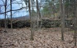
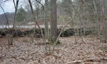
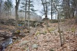
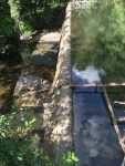
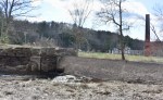
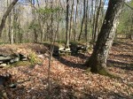
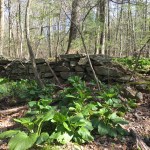
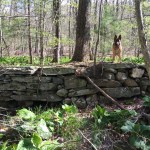
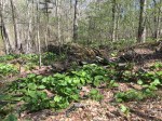
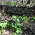
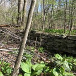
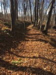
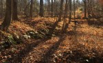
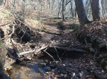
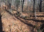
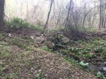
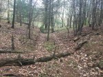
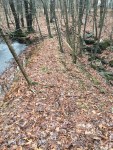
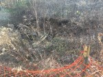
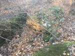
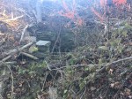
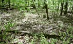
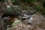
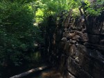
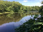
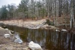
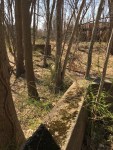
Roaring Brook was once the industrial backbone of Glastonbury. Around 29 dams were built on the stream and its tributaries, nearly all of which survive to this day. Albasi Dam is one of them, located in the northeastern corner of town near the border with Bolton and Manchester.
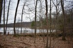
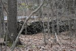
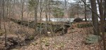
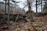
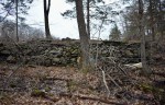
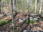
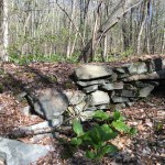
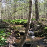
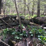
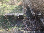
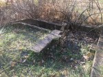
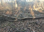
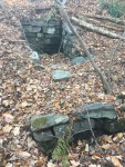
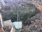
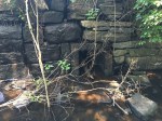
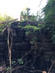
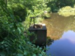
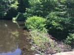
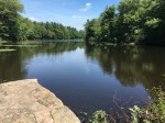
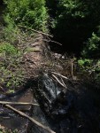
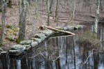
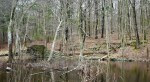
The dam still stands and holds back a sizable pond, roughly similar-sized to Eastbury Pond. It’s a mix of stone and earth, only a few feet tall but roughly 200 feet wide. While the dam isn’t in great shape, it looks study enough and features what appears to be a sluiceway on the eastern end. It’s clogged up thanks to a combination of trash, leaves and an old beaver dam, whose lodge is located directly behind the dam in the water.
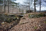
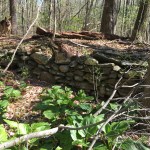
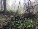
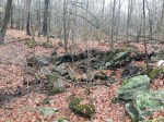
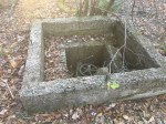
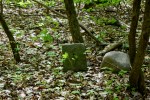
According to “The Memorial History of Hartford County” by James Hammond Trumbull, there “was a saw-mill run by Nathaniel Hubbard,” noted as being near the head of Roaring Brook and upstream of Coop Sawmill. As of now, the only known dams upstream from Coop Sawmill are the Shenipsit Dam and now, Albasi Dam. While neither is located on Roaring Brook proper, they’re the only two candidates.
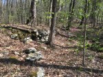
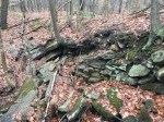
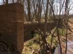
Albasi Dam makes more sense considering there is still a sluiceway visible along with piles of rocks along it that could’ve been the foundation for a mill.
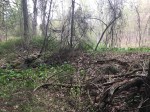
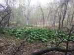
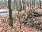
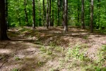
The dam itself appears to be located on private property but the property line to the Manchester Water Company appears close enough to get a decent look at it.
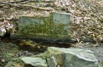
History is temporary. Mother Nature is undefeated.
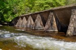
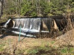
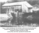
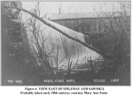
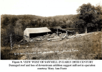
Portions of the Slocumb Dam has stood for over 180 years, with renovations coming to other parts in 1995. But in March 2017, a large hole burst in the dam. The town lowered the water behind it to reduce pressure, also removing the picturesque mill pond.
The original dam was made of the stone to power the Hopewell Mill built on the site. It was two-sided and the far side is still the original. It was made of huge blocks of stone and remains in good shape despite approaching 200 years. Over on this side are concrete stairs that were built, likely much later, although their purpose isn’t abundantly clear.
The new side was made of concrete and, unsurprisingly, is also the side with the issues. It’s odd shaped, with the a base, a slanted wall and supports to hold it up. In between two of these supports is where the hole broke through.
The town is still evaluating their options, although the likely outcome is part of the dam is removed to allow the free-flow of water again while also minimizing the removal so the dam itself can still be seen for historical purposes.
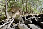
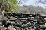
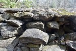
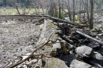
It’s a small dam, made of stone shaped in a “L” shape, although both sides appear to be equal in length. There’s a raceway that goes from the southern-most point towards Hebron Avenue before disappearing into the raised surface of the road.
The purpose of the dam is a mystery. It doesn’t appear on maps available on the internet. It appears to have been abandoned for a long, long time and was probably stood a few feet taller when it was built. The stream cuts deep into the ground which indicates that years of leaves and other decayed matter built up that high.
The sluiceway indicates that the water was collected and directed for a purpose but the new section of Hebron Avenue likely buried any ruins that could’ve offered other hints.
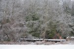
Woolen mills were common throughout Glastonbury in the 1800’s, with Eastbury Pond, Shoddy Mill, Cotton Hollow among some of the many producing mills producing linens and other fabric materials. One of the more forgotten carding mills from this age is the Buckingham Carding Mill, located nearby to the intersection of Hebron Avenue and Keeney Street – an area once known as “Hurlburt Corner”.
Few records are left of the mill aside from a mention on a plaque about Hurlburt Corner and on some old maps of Glastonbury. It was out of business and the dam broken by the time aerial photographs came around in the 1930’s.
The dam isn’t that large and it is mostly made of dirt with some stones mixed in. But on the southern bank of the stream, a 400-foot sluiceway travels out away from the dam. It winds through the forest before eventually coming to an end just before Keeney Street. It’s still imprinted into the earth well-enough to be visible from satellite maps and from the road in the winter.
The mill was also located close to the Howe Street School, which was situated where Hebron Avenue currently meets Chalker Hill and Keeney Street. The re-aligned of the road removed any traces of its existence.
On the opposite bank of the stream are the remains of an ancient house, owned by “GH” according to a 1874 map of Glastonbury.
Before the dawn of cars, planes and trains, rivers were the best mode of transportation for people and goods. Glastonbury has the perfect location along the Connecticut River, using it to ship goods from the many mills on the town.
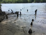
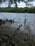
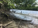
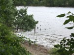
The South Glastonbury Dock was once a hub of activity, located just south of the ferry. From 1892-1931, this dock was used to unload people and cargo for the local paper mills. The steamships “Hartford” and “Springfield” were the ships that used the dock (Glastonbury Historical Society).
At certain times, the remains of the dock can be seen when the river is low enough. The wood has mostly rotted away, but the base of the posts are still sticking out of the mud.
They were one of three docks in Glastonbury, along with a coal dock just north and the ones at Riverfront Park.
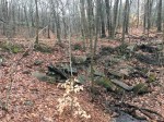
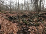
Just off the shore of Buckingham Reservoir in a pine grove, a dilapidated dam sits forgotten.
Mostly made of dirt and stone, the dam has fallen apart and no longer holds any water behind, simply a swampy area. It was likely used for irrigation before Buckingham Reservoir existed due to the lack of a sluiceway to power anything.
Nearby is a clearing but there’s no sign of any old foundation or anything, but a visible driveway comes up from the Old Coop Road to it.
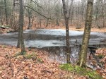
Rockwell Dam is a small, stone dam located just off Hebron Avenue and north of the abandoned Rockwell Street. It holds back a small, mostly filled pond.
The dam was likely used to irrigation purposes, due to the fact that not only is there no sluiceway visible to divert the water to power something nearly but it is located nearby the farmstead ruins off Rockwell Street.
There are no records of the dam, so the date is unknown. It appears to be pretty old as the dam is in bad shape and is mostly held together by roots and dirt.
During its peak, the JB Williams Soap Factory was one of the largest producers of hygiene products in the nation. With such high demand, the company needed plenty of resources, as seen by the mill remains that have since been turned into apartments.
However, upstream from the site is a park named after JB Williams, and for good reason. The company used the area as a water source and it was eventually used as a reservoir to provide water to local residents until the mid-1960’s, when the town finally purchased the property. The remains from that time can still be seen today.
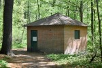
Visitors of the park are greeted immediately with the abandoned pumphouse. A small, brick building sits quietly next to the road leading to the pavilion, with just a single door and boarded-up windows. While electric wires are still connected to the building, its been decades since it was last used.
Lower Pond
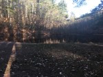
Arguably the most prominent feature of the park, the lower pond (Often called Williams Pond, although multiple ponds in Glastonbury claim that name) is held back by a small earthen dam, roughly seven feet tall and 150 feet wide. The sluiceway is located on the south side with stone footings of what appear to be small bridges used before the area became a park.
Within the pond is a closed concrete structure that has shown its age, as much of it is crumbling. It was likely used to draw in water from the pond which then went to the nearly pumphouse where it travelled to the mills.
Nearby, at the foot of the dam is another concrete structure, this one open. Inside is the remains of what appears to be a wheel that may have been used to open and close the pump located in the pond.
Looking at the pond from the top of the dam.
The top of the dam.
The pump at the base of the dam.
Upper Pond
Roughly a quarter-mile upstream from Williams Pond is a smaller pond, often referred to as “Dog Pond” by people who use the park. The pond doesn’t really exist anymore after the town broke the dam and released the water in the mid-2000’s.
The dam is mostly earthen, with some extra boulder reinforcement. Since the pond was never anything that large, the dam is also somewhat small, sitting no more than seven feet tall and stretching about 20 feet.
On the north side of pond is the old sluiceway into the pond. The stream ran this way into the late ’90’s before being diverted into its current path. They are all-concrete and take a 90-degree turn into the pond.
The upper pond was also used as a source of water as seen from the open concrete structure similar to the one found near Williams Pond. This one is in better shape with multiple layers as well as the wheel still intact.
There are also a handful of small stone structures found around the pond, although their purposes aren’t very clear.
The remains of the pond.
The break in the dam.
The old sluiceway.
The concrete structure.
An unknown rock structure.
Upper Waterways
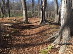
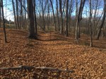
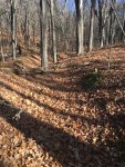
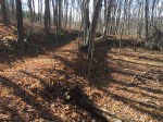
The stream that drains into the Upper Pond is unique. As it winds through the woods, there are stones that seem to be guiding it in different directions as well as some small dam type structures that give the sense of a man-man stream.
It leads up to an old concrete sluiceway in the shape of a “U”, similar to those at Buckingham Park. Next to it is a long concrete slab with rounded rocks around.
At the “U” structure, a deep trench goes off in a different direction, although it is dry and seems to have been that way for a while. The water likely collected behind the dam and the sluicegate was used to control how much water would travel down the raceway.
Just behind these structures is a small gully with some water dribbling down it. Within the gully are three stone structures, but their purposes are unknown. Two are square-shaped, one at the top of the gully and another towards the middle. The other looks like a retaining wall in the middle of the gully.
One possibility is that there were (or are) springs where the structures are and they were built to pull the water directly from them. However, historical information on the entire park is limited.
The stone and concrete dam.
The lower stone structure.
The upper stone structure.
One of the small stone structures on the stream.
A small dam on the stream.
The raceway.
Southern Dam
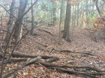
Near the upper pond are remnants of an old road heading south up a hill. Under the leaves are some old bits of asphalt and rock while the path of the road itself is rather clear. This leads up to an old dam at the top of the hill, the purpose of which is unknown.
Remains of the road.
The path of the road.
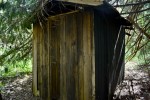
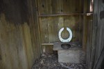
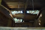
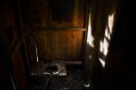
Abandoned Outhouse
Near the top of the old ski hill is an outhouse that has been forgotten behind a tall pine tree. The structure is beginning to fall apart with the roof caving in on one side and the wood rotting all around. There were two stalls with single toilet holes in each.
Other structures
There are a variety of other lost structures in the park. The caption on the photo explains each each.
A pipe that runs on up the hill on the southeast side of the main pond.
A concrete slab near the road up to the southern dam.
A concrete dam down the trail from the outhouse.
A trench that runs down the hill from the southeast.
The same trench.
Stone structures on the stream past the spillway of the main pond.
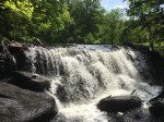
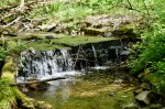
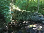
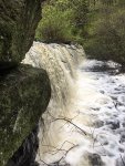
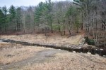
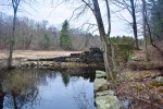
Blackledge Falls is more well-known for its namesake than it is for the history within the park. However, that history still plays a major role.
Long ago on what is now the park, a dam was used to a power an up-and-down sawmill along the Blackledge River. It was built c. 1810, where a sawmill remained until 1935. After the mill closed, it was moved up to Sturbridge Village as one of the many displays.
Credit: Raber Associates document
Credit: Raber Associates document
Credit: Raber Associates document
Credit: Raber Associates document
The pond was then used by both the Cheney Family of Manchester and the Danskin Family of Glastonbury as a summer retreat. There were two cabins on the site, one of which can still be seen on the eastern side of the pond. The other was located on the western side of the water but burned down in the early 2000’s.
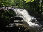
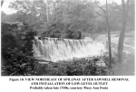
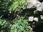
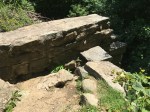
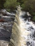
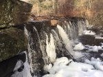
The dam stood in decent condition up until 2018, when it was removed by the Town of Glastonbury as environmental compensation for placing riprap in the Connecticut River along the boathouse. It spanned 178 feet and stood just six feet high. The mill stood on the eastern end, straddling the top of the mill and the ground.
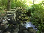
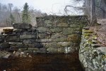
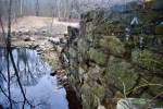
In the pond itself, there was a wheel that opened and closed the sluicegate to increase/decrease the waterflow through the mill. When the town tried to drain the pond to begin the removal project, those pipes were clogged by beavers. The sluicegate is a small square, about a square foot. Part of the sluiceway can still be seen where the rocks line the shore to guide the water. On the western side, there used to be a stone wall that made up the beginning of the dam before the larger, square rocks began with a small, stone platform that viewers could sit on.
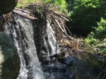
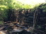
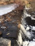
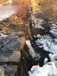
While the Blackledge River now flows freely where the dam once stood, the eastern-most portion of the structure still exists. The remains slope up from the stream bed to the shore, where a perpendicular stone wall once served as part of the foundation to the mill. The sluicegate is still visible as well as the previous remains from the sluiceway.
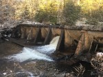
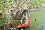
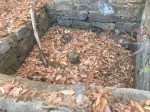
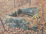
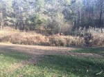
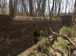
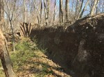
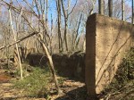
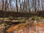
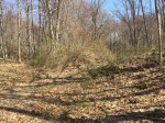
Dams, no matter how big or small, are engineering marvels. With only so much stone or dirt, it holds back a large amount of water and the pressure that comes with it. Because of this, most dams are built in valleys where the dam can be as small as possible to limit costs and potential damage. The Naubuc Paper Company Dam is the exception.
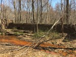
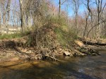
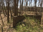
The dam is extremely long, spanning over 100 yards long. The southern most section is made of cement but isn’t located on the stream anymore, making it look less like a dam and more like a random large brown structure sitting in the middle of the woods. The old sluicegate can still be seen but has mostly filled in with dirt and leaves.
There’s a puddle of water at the base of the dam that has been contaminated with iron and other metals, making it a bright orange color. Luckily, the contamination doesn’t reach Salmon Brook, so it is hopefully limited to the one area.
The rest of the dam is earthen and makes up the majority of the dam. It is about 10 feet tall and looks just like any normal embankment, except it stretches the length of a football field. Near the concrete part, it has been breached to allow the stream to flow through again.
The date of when the dam was built is unknown and its unclear if it was used for the other industries that occupied the area, such as a grist mill. However, it was likely breached in the 1940’s when the mill was torn down.