Buckingham Carding Mill Dam

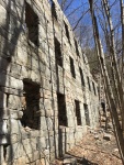
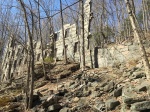
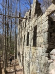
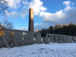
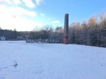
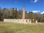
Woolen mills were common throughout Glastonbury in the 1800’s, with Eastbury Pond, Shoddy Mill, Cotton Hollow among some of the many producing mills producing linens and other fabric materials. One of the more forgotten carding mills from this age is the Buckingham Carding Mill, located nearby to the intersection of Hebron Avenue and Keeney Street – an area once known as “Hurlburt Corner”.

Few records are left of the mill aside from a mention on a plaque about Hurlburt Corner and on some old maps of Glastonbury. It was out of business and the dam broken by the time aerial photographs came around in the 1930’s.

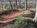
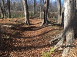
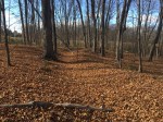
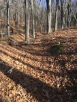
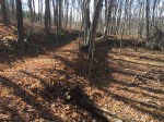
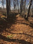
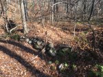
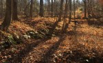
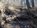
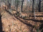
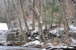
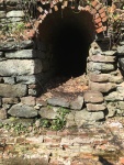
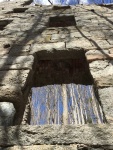
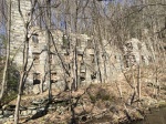
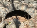
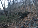
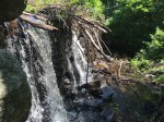
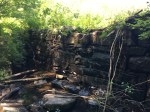
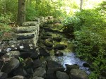
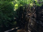
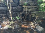
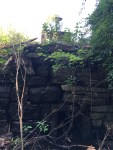
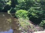
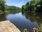
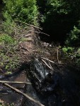
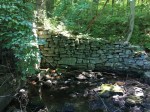
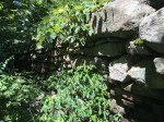
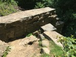
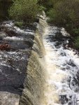
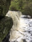
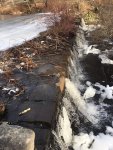
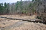
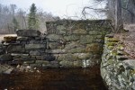
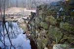
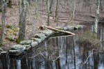
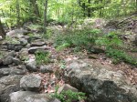
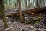
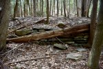
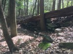
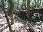
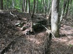
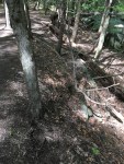
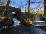
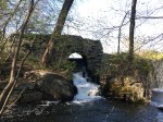
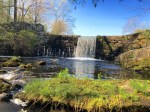
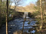
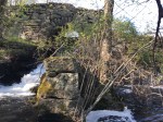
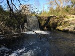
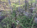
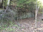
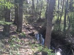
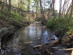
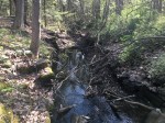
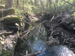
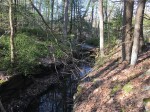
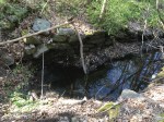
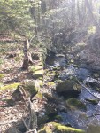
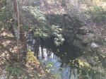
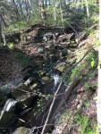
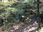
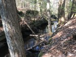
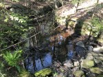
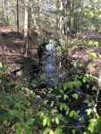
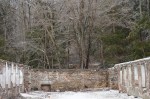
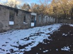
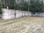
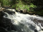
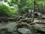
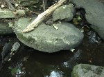
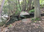
The dam isn’t that large and it is mostly made of dirt with some stones mixed in. But on the southern bank of the stream, a 400-foot sluiceway travels out away from the dam. It winds through the forest before eventually coming to an end just before Keeney Street. It’s still imprinted into the earth well-enough to be visible from satellite maps and from the road in the winter.

The mill was also located close to the Howe Street School, which was situated where Hebron Avenue currently meets Chalker Hill and Keeney Street. The re-aligned of the road removed any traces of its existence.

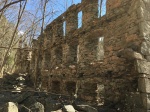
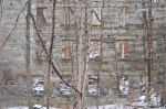
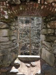
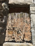
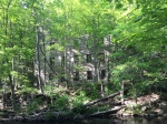
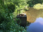
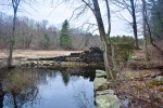
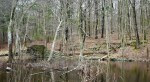
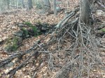
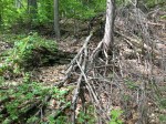
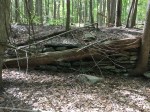
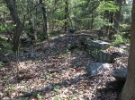
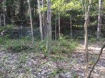
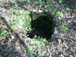
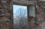
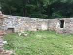
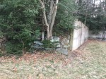
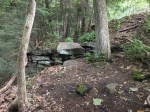
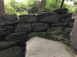
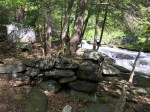
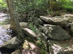
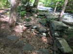
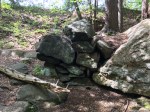
On the opposite bank of the stream are the remains of an ancient house, owned by “GH” according to a 1874 map of Glastonbury.

Cotton Hollow Mill Ruins

SAVE THE COTTON HOLLOW MILL

Standing in the southern end of the Cotton Hollow Preserve looms the hulking four-story ruins of a different time in the South Glastonbury ravine. Before the days of hiking, swimming and fishing, industry ruled the area as dozens of mills once harnessed the water to power themselves – the biggest of which was the cotton mill in the lower half of Cotton Hollow.

It was built in 1814 by the Hartford Manufacturing Company, who owned it until the mid-1800’s. From there, the mill changed hands frequently and by 1920, the era of industry within Cotton Hollow came to a close. At its height, the mill employed 350 people, many of which lived in the nearby housing on Cotton Hollow Road and the Cotton Hollow mill houses.

The mill was powered by two large dams, rising 25-feet and 40-feet, respectively. The smaller dam was built after so much water flowed over the top of the larger dam that they determined it a good idea to harness the extra water. The remains of both those dams can still be seen.

The stone cotton mill was one of two mills in the area, with the other being a brick mill across the stream. While it has mostly disappeared, some ruins can still been on the island across from the stone mill. According to “A Memorial History of Hartford County” by J. Hammond Trumbull (1884), the interior of the stone mill burned down was subsequently rebuilt.

Three stories of the facade of the mill still remain, although Mother Nature has taken its toll on the ruins over the years. It is an impressive architecture feat, as it was built directly into the side of the hill. According to town historian Brian Chiffer, raw materials were driven up to the fourth floor and as the cotton was moved down each level, it was refined more and more before the final product came out of the bottom floor.

At the bottom of the mill on the banks of Roaring Brook is an old cold cellar that can still be seen. The brick structure disappears into darkness and was used as a pre-electricity refrigerator.

Despite being well-protected by the Historical Society of Glastonbury, nature has taken a toll on the mill. It no longer stretches into the sky as high as it once did and the remains will only crumble more as time continues on. Cotton Hollow is the best example that no matter how well something is built, nature will always come out victorious.


Blackledge Falls Dam

Blackledge Falls is more well-known for its namesake than it is for the history within the park. However, that history still plays a major role.

Long ago on what is now the park, a dam was used to a power an up-and-down sawmill along the Blackledge River. It was built c. 1810, where a sawmill remained until 1935. After the mill closed, it was moved up to Sturbridge Village as one of the many displays.

The pond was then used by both the Cheney Family of Manchester and the Danskin Family of Glastonbury as a summer retreat. There were two cabins on the site, one of which can still be seen on the eastern side of the pond. The other was located on the western side of the water but burned down in the early 2000’s.

The dam stood in decent condition up until 2018, when it was removed by the Town of Glastonbury as environmental compensation for placing riprap in the Connecticut River along the boathouse. It spanned 178 feet and stood just six feet high. The mill stood on the eastern end, straddling the top of the mill and the ground.

In the pond itself, there was a wheel that opened and closed the sluicegate to increase/decrease the waterflow through the mill. When the town tried to drain the pond to begin the removal project, those pipes were clogged by beavers. The sluicegate is a small square, about a square foot. Part of the sluiceway can still be seen where the rocks line the shore to guide the water. On the western side, there used to be a stone wall that made up the beginning of the dam before the larger, square rocks began with a small, stone platform that viewers could sit on.

While the Blackledge River now flows freely where the dam once stood, the eastern-most portion of the structure still exists. The remains slope up from the stream bed to the shore, where a perpendicular stone wall once served as part of the foundation to the mill. The sluicegate is still visible as well as the previous remains from the sluiceway.

Related:

Blackledge Coal House

Pre-removal photos:

Post-removal photos:

Hunt’s Forge

SIGN THE PETITION TO SAVE THE COTTON HOLLOW MILL

Similar to Easton Grist Mill, Hunt’s Forge is an old industrial site within Cotton Hollow than can easily be missed. The remains of the foundation are mostly buried beneath a fallen tree, but one corner can still be seen as well as a dilapidated wall along the bank. It is located just below a clearing, nearby to the famous cliff-jumping rock in the bend of Roaring Brook.

Hunt’s Forge was an iron forge than produced items smaller than the anchors from Pratt’s Forge. Mainly, it made small, hand-held equipment such as farm tools. In such an agrarian society, these types of products were in high demand back then. However, the forge moved upstream when the Hartford Manufacturing Company built their mills upstream and did not want a small forge tapping into their waterpower. It would move to the current location of Pratt’s Forge, before it closed at some point during the 1800’s.

Not much remains of the forge, but remnants can still be seen.

Easton Grist Mill

SIGN THE PETITION TO SAVE THE COTTON HOLLOW MILL

The Easton Grist Mill is one of the oldest mills to operate within Cotton Hollow, dating back to pre-Revolutionary America. Most towns and villages had a grist mill to grind the grains grown in the many farms in town.

Since it was built before the Industrial Revolution, the way it was powered is unknown. Stone dams were not used at that time, so it’s possible the mill was hand-powered, a dam was built using logs, or the water wheel was placed directly into the moving stream.

Not much remains of the mill. Only a small wall of stone from the foundation is visible facing the water, as the rest of it has been filled in from years of decomposition. Above the remains, an iron “II” is nailed to the tree. It can be hard to spot, as a long has fallen onto the wall.


Smut Pond

DISCLAIMER: While Smut Pond and its dam are owned by the town of Glastonbury, the surrounding area is private property. If you visit, please respect the local landowners and stay on the town-owned easement. The entire south bank of Roaring Brook from Woodland Road to Matson Hill Open Space (including Smut Dam and Flat Rock) as well as the north bank is private property. Trespassing is a criminal offense and after speaking with landowners will result in arrest.

Of the dams that still stand in Glastonbury, few have been built with the same craftsmanship and beauty as Smut Pond. Renovated in the 1970’s, the 15-foot high dam features a curved top with a remarkable arch sluiceway.

Depending on the time of year, water flows over the top, creating a picturesque waterfall. On the northern side, the arched sluicegate remains fully-functional. It empties into a little pool area, where some of it flows into the still-intact sluiceway. Sticks and other garbage have blocked up the flow of water, but the retaining walls are still visible, and can be followed all the way back to where it reconnects with Roaring Brook.

The sluiceway forms a small island, where some of the foundation of the mill still remains along with scrap metal scattered on the ground. There’s also some foundations and wells that can still be seen from the surround buildings.

The Hartford Courant details the history of the site well. The site was first occupied by a forge, which gives the area the name since the constant burning covered the entire area in black soot. Roaring Brook was dammed at this point as early as the 1700’s. The location changed hands around 1850 by the Hartford Manufacturing Company – the same company that owned the mill in Cotton Hollow.

Under the new ownership, two new mills were built and operated through the 19th century. Eventually, the JT Slocumb Company – who ran the Hopewell Mill upstream – gave the property to the town, who still owns it today.

Hopewell Mill

In every town there are parts of it that go by a different name, whether it’s a Census-Designated Place village like Moodus in East Haddam or just an unofficial name of a commercial center like Hopewell in Glastonbury.

The history of the Hopewell name in Glastonbury is simple but it shows how an off-hand comment can change impact the history of a town for centuries. Hopewell is a small hamlet in the Southeast Part of Glastonbury. There’s a school, firehouse some shops and road that all use the Hopewell name.

The name comes from a mill, just off Hopewell Road near Cotton Hollow in South Glastonbury. One of the oldest industrial sites in town, as one of the first sawmills was supposedly built in the same location. However, Hopewell Mill came about in 1836, built by Amos and Sprowell Dean.

One day, one of the Deans came home and his wife asked what they would name the mill.

“I don’t know,” he replied. “But we’ll hope well on the mill whatever we call it.”

And the name stuck.

Originally, the mill produced woolen goods. But in the mid 1800’s, it became Hollister and Glazer, who produced uniforms for the Union Army in the Civil War. Jump ahead 100 years and the property was purchased by JT Slocomb Company, which produced aircraft parts. This company rebuilt part of the original dam and expanded the mill to over 19 buildings. Like most of the mills in town, the company eventually folded and the town purchased the property. The tore down everything with the exception of the original walls and smokestack and designated the area Matson Hill Open Space.

Only the first floor and smokestack remain from the original structure. Recently, the walls were saved from demolition by the Glastonbury Historical Society, who paid to repair them. On one side of the clearing, concrete foundations can still be seen in the walls.

The nearby Slab Gut Brook Dam was used as a water source in case of fire back in the day. Along Roaring Brook is a concrete wall with pipes sticking out.

Related:

Slocumb Dam
Slab Gut Brook Dam
Smut Pond Dam
Cotton Hollow

Pratt’s Forge – Glastonbury Anchor Works

SIGN THE PETITION TO SAVE THE COTTON HOLLOW MILL

The first site within Cotton Hollow is Pratt’s Forge, also known as Glastonbury Anchor Works. The remains represent the history of the location but it also represents the lost industry of Glastonbury: Shipbuilding.

With the Connecticut River as it’s west-most boundary, Glastonbury was one of the biggest shipbuilding towns in the state, launching boats from Log Landing in South Glastonbury in the area of Pease Lane. Local legend states that the industry died when the railroad came to Connecticut and rail bridges were built across the Connecticut River, therefore making it impossible for the masted ships to traverse the waterway.

While the site is best known for its anchors, it originally began as a smaller forge that produced smaller goods such as farm equipment. The forge first operated farther downstream (where the remains can still be seen) but when the Hartford Manufacturing Company built its mills and dams, the forge relocated to a new spot.

Eventually, it became an anchor forge with a handful owners before George Pratt – once a worker in the forge itself – purchased it. It produced anchors for much of the latter half of the 1800’s but by 1893, the building was in disrepair.

The remains of Glastonbury Anchor Works are still quite visible. The dam, while now broken, still stands on a large rock with Roaring Brook cutting through it. The sluicegate can still be seen on the south bank, although it no longer functions. Much of the foundation of the building can still be seen as well, as large stones line the stream and parts of the sluiceway remain where the water was released back into the brook.

The bank is also covered with slag, a metal byproduct created during the iron refinery process. If you look close enough, you can also find small pieces of charcoal used to mold the iron as well.

Pratt’s Forge is located directly behind the Grange Pool. Park at the preserve off Hopewell Road and follow the trial left.

PHOTOS: