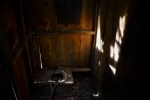
Editor’s note: The site’s policy is to only cover abandoned locations within the boundaries of Glastonbury. But because of the importance of the site and the fact that it’s right across the border in Portland, I felt it was important to get photographs of the remains. The photos are also only from the control center located on Del Reeves Road. When we visited the launch site off North Mulford Road, I quickly decided to leave due to safety concerns before I took any photos.
Before the days of automobiles that could easily transport students to a central school, one-room schoolhouses were used to educate kids within a reasonable distance of their homes. In Glastonbury, there were as many as 18 different school districts at one point.
Most of the old schools still exist. Some of the old one-room schoolhouses have been converted to private homes, such as District 3, Taylortown School, Wassuc School and Nayaug School. District 14 is a community club, District 18 is occupied by Glastonbury Youth and Family Services, District Four is used by the American Legion and Audubon Society while Eastbury School is a library. Not all remain though. Some have been demolished and are gone.
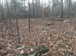
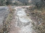
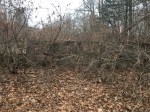
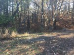
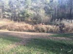
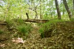
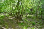
The remains of one exist on the corner of Old Hebron Avenue and Old Coop Road. Buckingham School was built in the 1800’s and was eventually replaced by a larger school down the road at 2341 Hebron Avenue (Also called Buckingham School, now a private home).
The original Buckingham School stood at least until 1934, when these aerial photos were taken. A photo of the school was taken in 1919, though with the new Buckingham School built in 1895 according to realtor websites, it’s not clear if the original was still an operational school.
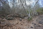
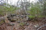
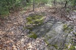
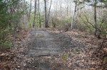
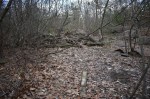
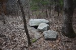
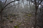
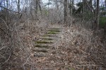
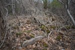
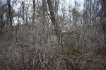
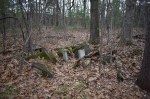
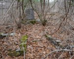
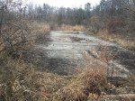
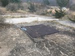
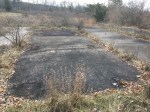
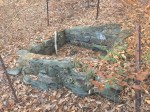
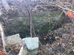
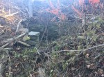
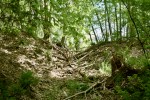
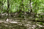
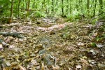
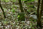
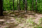
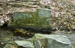
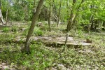
The school wasn’t built with a cellar hole foundation, so only a slight depression is seen from where it used to stand. There’s a line of brick where the western part of the building was and large slabs of stone on the opposite end were likely the steps up to the door. The building appears to have collapsed on itself as there are a lot of old nails in the ground.
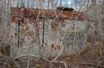
The foundation.
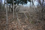
The stone stairs.
The depression in the ground where the building stood with the foundation bricks in the background.
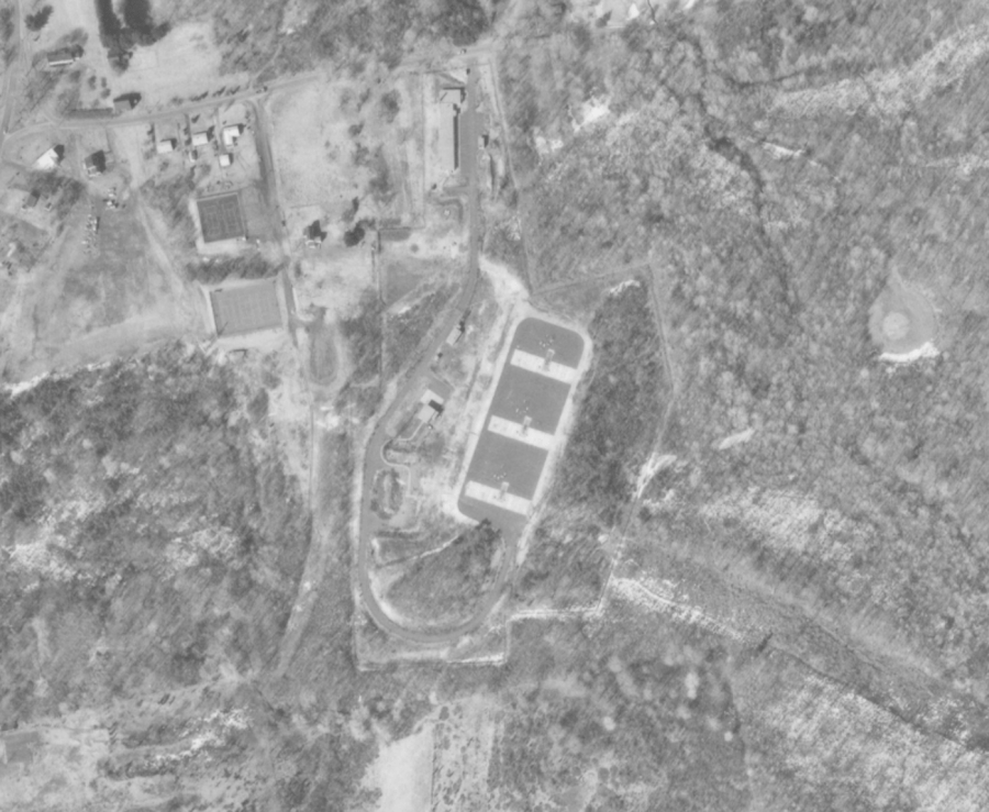
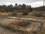
During the Cold War, 12 Nike Missile sites were built throughout Connecticut to defend against Russian bombers. These sites had two parts: A headquarters, which housed the radar, and a launch pad, or battery. Glastonbury houses the battery for HA-25, the Nike Missile site located in Manchester.
An aerial photo of the launch bad in 1970.
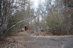
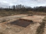
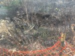
The location wasn’t active long, with its only operational years coming between 1956 to 1961. The battery was located off Line Street, although many of the buildings along with the entrance were removed after the land was developed for housing. The battery and part of the driveway still remain under power lines that travel across the town.
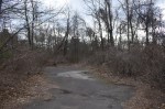
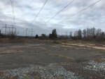
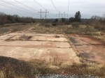
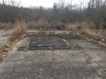
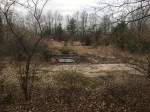
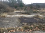
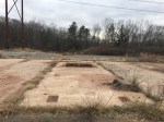
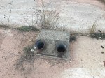
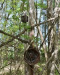
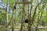
The battery is just a flat concrete and asphalt surface that could be mistaken for an old parking lot. Most of the operations were done either in Manchester or underground, so there isn’t much to see. Most of the battery is overgrown by grass and weeds. There were three launch pads at the battery which could launch four separate missiles.
Each pad could support four missiles on above ground rails, with additional missiles stored underground. A large elevator was used to bring the missile to the surface. The steel plates were blast shields
would have protected the concrete from the heat of the rocket engines.
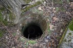
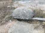
The bunker below was probably partially filled with debris when the site was decommissioned. Many batteries have flooded over the years.
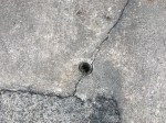
Most of the blast shields can still be seen in addition to other supports for the missile. There are also a handful of smaller structures that were likely used as air vents for the underground rooms or to bring wires to the surface. Everything underground has been filled in and there are no access points.
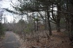
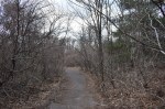
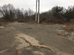
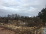
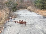
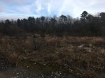
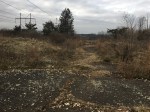
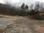
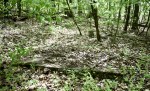
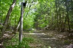
On the south side of the battery is a driveway that winds down into the woods but turns back towards Line Street and comes back under the wires, parallel to the battery. It re-enters the woods on the other side of the power lines, where it is overgrown and the road is deteriorating, with a handful of collapsed spots. There is a wall of concrete blocks that stops any vehicle traffic from coming up.
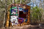
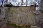
During its peak, the JB Williams Soap Factory was one of the largest producers of hygiene products in the nation. With such high demand, the company needed plenty of resources, as seen by the mill remains that have since been turned into apartments.
However, upstream from the site is a park named after JB Williams, and for good reason. The company used the area as a water source and it was eventually used as a reservoir to provide water to local residents until the mid-1960’s, when the town finally purchased the property. The remains from that time can still be seen today.
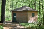
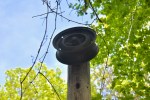
Visitors of the park are greeted immediately with the abandoned pumphouse. A small, brick building sits quietly next to the road leading to the pavilion, with just a single door and boarded-up windows. While electric wires are still connected to the building, its been decades since it was last used.
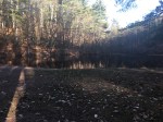
Lower Pond
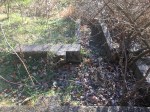
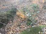
Arguably the most prominent feature of the park, the lower pond (Often called Williams Pond, although multiple ponds in Glastonbury claim that name) is held back by a small earthen dam, roughly seven feet tall and 150 feet wide. The sluiceway is located on the south side with stone footings of what appear to be small bridges used before the area became a park.
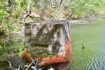
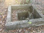
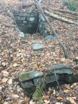
Within the pond is a closed concrete structure that has shown its age, as much of it is crumbling. It was likely used to draw in water from the pond which then went to the nearly pumphouse where it travelled to the mills.
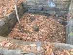
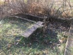
Nearby, at the foot of the dam is another concrete structure, this one open. Inside is the remains of what appears to be a wheel that may have been used to open and close the pump located in the pond.
Looking at the pond from the top of the dam.
The top of the dam.
The pump at the base of the dam.
Upper Pond
Roughly a quarter-mile upstream from Williams Pond is a smaller pond, often referred to as “Dog Pond” by people who use the park. The pond doesn’t really exist anymore after the town broke the dam and released the water in the mid-2000’s.
The dam is mostly earthen, with some extra boulder reinforcement. Since the pond was never anything that large, the dam is also somewhat small, sitting no more than seven feet tall and stretching about 20 feet.
On the north side of pond is the old sluiceway into the pond. The stream ran this way into the late ’90’s before being diverted into its current path. They are all-concrete and take a 90-degree turn into the pond.
The upper pond was also used as a source of water as seen from the open concrete structure similar to the one found near Williams Pond. This one is in better shape with multiple layers as well as the wheel still intact.
There are also a handful of small stone structures found around the pond, although their purposes aren’t very clear.
The remains of the pond.
The break in the dam.
The old sluiceway.
The concrete structure.
An unknown rock structure.
Upper Waterways
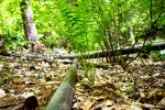
The stream that drains into the Upper Pond is unique. As it winds through the woods, there are stones that seem to be guiding it in different directions as well as some small dam type structures that give the sense of a man-man stream.
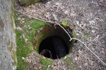
It leads up to an old concrete sluiceway in the shape of a “U”, similar to those at Buckingham Park. Next to it is a long concrete slab with rounded rocks around.
At the “U” structure, a deep trench goes off in a different direction, although it is dry and seems to have been that way for a while. The water likely collected behind the dam and the sluicegate was used to control how much water would travel down the raceway.
Just behind these structures is a small gully with some water dribbling down it. Within the gully are three stone structures, but their purposes are unknown. Two are square-shaped, one at the top of the gully and another towards the middle. The other looks like a retaining wall in the middle of the gully.
One possibility is that there were (or are) springs where the structures are and they were built to pull the water directly from them. However, historical information on the entire park is limited.
The stone and concrete dam.
The lower stone structure.
The upper stone structure.
One of the small stone structures on the stream.
A small dam on the stream.
The raceway.
Southern Dam
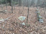
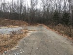
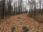
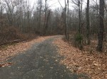
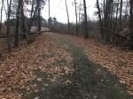
Near the upper pond are remnants of an old road heading south up a hill. Under the leaves are some old bits of asphalt and rock while the path of the road itself is rather clear. This leads up to an old dam at the top of the hill, the purpose of which is unknown.
Remains of the road.
The path of the road.
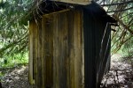
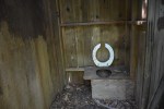
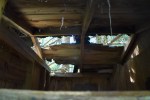
Abandoned Outhouse
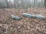
Near the top of the old ski hill is an outhouse that has been forgotten behind a tall pine tree. The structure is beginning to fall apart with the roof caving in on one side and the wood rotting all around. There were two stalls with single toilet holes in each.
Other structures
There are a variety of other lost structures in the park. The caption on the photo explains each each.
A pipe that runs on up the hill on the southeast side of the main pond.
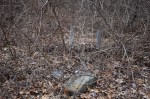
A concrete slab near the road up to the southern dam.
A concrete dam down the trail from the outhouse.
A trench that runs down the hill from the southeast.
The same trench.
Stone structures on the stream past the spillway of the main pond.
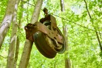
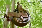
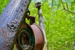
In the mid-20th century, small ski hills popped up throughout Connecticut for people to get their skiing fix in without having to travel up to Vermont or New Hampshire. There were over 60 of these ski hills around the state, including one in Glastonbury.
Located within JB Williams Park, the ski hill was a simple tow rope with one main slope along with some bushwhacked woods trails. The tow rope was powered by an old Willis Jeep parked at the bottom of the hill which ran the rope off its rear tire.
Information in this paragraph provided by nelsap.org. They’re the best source for lost ski hills in CT and have some great photos and stories from people who used the ski hill.
According to a man who built the hill, it was easy for people to access it off Neipsic Road because there was an empty lot at the top of the hill. But in 1973, 911 Neipsic Road was built, thus cutting off access to the hill. Since people were less inclined to carry their skies and boots in through the woods, the hill closed shortly after.
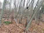
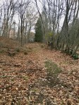
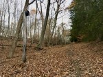
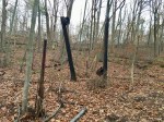
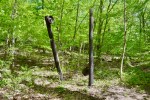
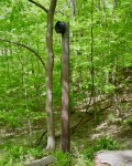
Today, the poles and wheels that carried the tow rope still stand, along with a path where the tow rope once carried skiers up the hill. At the top of the hill, a larger contraption still stands where the rope likely fed into the Jeep, which is no longer there. However, the concrete slab that it sat on is still visible The slope can’t be seen anymore as trees were likely planted when the hill closed to discourage skiing but the top where the skiers got off the tow rope is still open.
Looking up the hill.
Looking up the hill.
The tow rope (left) and ski hill (right).
Looking down the hill.
The concrete slab where the Jeep that powered the rope sat.


