During its peak, the JB Williams Soap Factory was one of the largest producers of hygiene products in the nation. With such high demand, the company needed plenty of resources, as seen by the mill remains that have since been turned into apartments.
However, upstream from the site is a park named after JB Williams, and for good reason. The company used the area as a water source and it was eventually used as a reservoir to provide water to local residents until the mid-1960’s, when the town finally purchased the property. The remains from that time can still be seen today.
RELATED: JB Williams Ski Hill
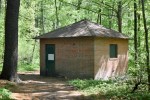
Pumphouse
Visitors of the park are greeted immediately with the abandoned pumphouse. A small, brick building sits quietly next to the road leading to the pavilion, with just a single door and boarded-up windows. While electric wires are still connected to the building, its been decades since it was last used.

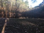
Lower Pond
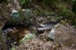
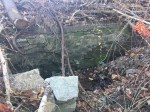
Arguably the most prominent feature of the park, the lower pond (Often called Williams Pond, although multiple ponds in Glastonbury claim that name) is held back by a small earthen dam, roughly seven feet tall and 150 feet wide. The sluiceway is located on the south side with stone footings of what appear to be small bridges used before the area became a park.
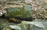
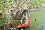
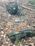
Within the pond is a closed concrete structure that has shown its age, as much of it is crumbling. It was likely used to draw in water from the pond which then went to the nearly pumphouse where it travelled to the mills.
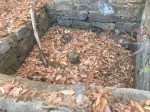
Nearby, at the foot of the dam is another concrete structure, this one open. Inside is the remains of what appears to be a wheel that may have been used to open and close the pump located in the pond.
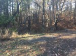

Upper Pond
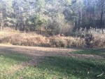
Roughly a quarter-mile upstream from Williams Pond is a smaller pond, often referred to as “Dog Pond” by people who use the park. The pond doesn’t really exist anymore after the town broke the dam and released the water in the mid-2000’s.
The dam is mostly earthen, with some extra boulder reinforcement. Since the pond was never anything that large, the dam is also somewhat small, sitting no more than seven feet tall and stretching about 20 feet.
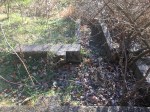
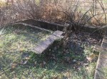
On the north side of pond is the old sluiceway into the pond. The stream ran this way into the late ’90’s before being diverted into its current path. They are all-concrete and take a 90-degree turn into the pond.
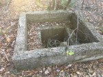
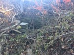
The upper pond was also used as a source of water as seen from the open concrete structure similar to the one found near Williams Pond. This one is in better shape with multiple layers as well as the wheel still intact.
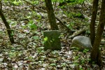
There are also a handful of small stone structures found around the pond, although their purposes aren’t very clear.
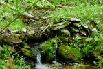
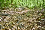
Upper Waterways
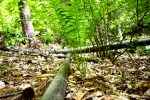
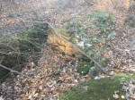
The stream that drains into the Upper Pond is unique. As it winds through the woods, there are stones that seem to be guiding it in different directions as well as some small dam type structures that give the sense of a man-man stream.
It leads up to an old concrete sluiceway in the shape of a “U”, similar to those at Buckingham Park. Next to it is a long concrete slab with rounded rocks around.
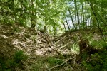
At the “U” structure, a deep trench goes off in a different direction, although it is dry and seems to have been that way for a while. The water likely collected behind the dam and the sluicegate was used to control how much water would travel down the raceway.
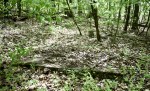
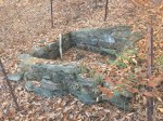
Just behind these structures is a small gully with some water dribbling down it. Within the gully are three stone structures, but their purposes are unknown. Two are square-shaped, one at the top of the gully and another towards the middle. The other looks like a retaining wall in the middle of the gully.
One possibility is that there were (or are) springs where the structures are and they were built to pull the water directly from them. However, historical information on the entire park is limited.
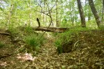
Southern Dam
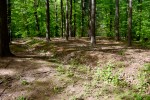
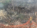
Near the upper pond are remnants of an old road heading south up a hill. Under the leaves are some old bits of asphalt and rock while the path of the road itself is rather clear. This leads up to an old dam at the top of the hill, the purpose of which is unknown.
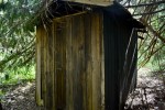
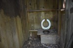
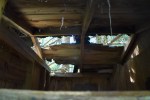
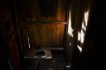
Abandoned Outhouse
Near the top of the old ski hill is an outhouse that has been forgotten behind a tall pine tree. The structure is beginning to fall apart with the roof caving in on one side and the wood rotting all around. There were two stalls with single toilet holes in each.
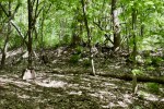
Other structures
There are a variety of other lost structures in the park. The caption on the photo explains each each.