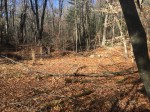
The Buckingham section of town is one of the most dense collection of historical ruins in Glastonbury and Buckingham Park is no exception. There are three small dams within the confines of the park, all on top of each other.
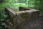
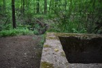
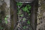
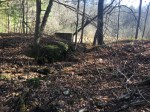
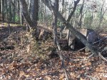
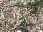
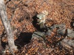
The lower dam is the most visible as the trail crosses right over it, which has caused erosion over the years. It’s small, standing no more than a few feet high but stretching nearly 20 yards across. It is mostly made of dirt, although there are some large rocks where the water now runs. Next to this is a U-shaped concrete structure which served as a sluicegate. There’s a pipe at the bottom and the water flow appears to have been controlled by a board placed in groves at the opening. This same structure is also found at JB Williams Park.
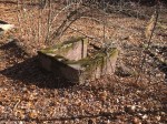
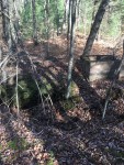
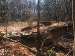
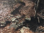
The middle dam is located on the same pond as the lower dam, although it has since been broken. It is the smallest of the three, as it is just as tall as the others but only stretches a few feet. It is completely earthen and does not have a sluicegate like the other two. However, it does have a handful of pipes sticking out of it.
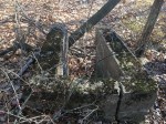
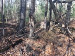
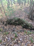
The upper dam is about the same size as the lower dam, although it had the largest pond of the three. It is long, short and made of dirt. It also has the sluicegate, although one side has since cracked. It no longer holds water as it has been broken like the others.
The history of these dams is pretty muddy. While they were likely used to just hold water, as they aren’t big enough to power a mill, it’s unclear why three dams were needed or what the water was used for. There are no records of anything in this specific area and there are no remains of anything around them. The middle and upper dams still held water according to aerial photos from the 1960’s, while the lower dam held until the 1990’s.


Buckingham Park Dams:
Merton Treat of the Buckingham William & Bertha Treat family told me about 70 years ago that there was a farm house, in the vicinity of the ponds, whose owner decided to break one of the dams so as to catch all the fish in a net spanning the break. I can’t recall the name at the moment but there is probably a Town record of that property.
I have often thought the dams should be restored so as to provide a bird sanctuary with ponds for wildlife. One can still observe ducks making do with what little water remains. They seem to have a fly path between the remaining pond water and the swamp water on the south side of Hebron Avenue.
LikeLike
That’s really interesting, I haven’t heard that before but it seems logical. Any idea what they were used for before the breach?
LikeLike
My guess is ponds (watering holes) for the farm.
P.S. I should have said that all the Willliam Treat family members are deceased.
LikeLike
Ponds or perhaps more properly called vernal pools (ephemeral pools, vernal ponds, vernal pools), are not uncommon in the vicinity of the Buckingham Park dams. I know of three of which only one remains.
One, locally referred to as Treat Pond, was located in the area of the island bounded by the Buckingham Fire Dept Station 4 access road, Hebron Avenue and Manchester Road.
A second vernal pool was located north of the intersection of Manchester Road and Hebron Avenue.
The above no longer exist because of the Manchester Road and Hebron Avenue intersection redesign in the 1960’s/1970’s. (No wonder wild life have difficulty eking out a living – there habitat was destroyed).
The third remaining vernal pool is located on the south side of Cricket Lane and north of Hebron Avenue.
LikeLike