Hebron Avenue, the major road in Glastonbury running east-to-west has seen its share of changes to straighten it out. Over the years, the road has been re-directed at least six times.
One of the biggest changes was Old Hebron Avenue. Half the road is still maintained by the town before the remainder of the road to the Manchester Water Company gate is chained off.
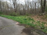
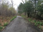
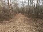
Beyond the gate is the access road to the Buckingham Reservoir. For about 50 yards, the road is paved and follows the old Hebron Avenue. The old telephone poles can still be seen on the sides at different points.
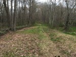
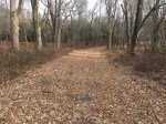
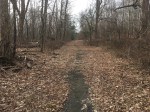
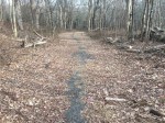
However, the pavement takes a sharp left and begins up Old Coop Road. The original road can still be followed by straight ahead. In certain spots, the old, broken pavement pokes through the grass, but it is mostly dirt. One side is a lined by the old rock wall that established the width of the road.
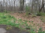
There are three foundations on the road: Buckingham School on the corner with Old Coop Road; I. Goslee House on the north side of the Old Hebron Avenue beyond the intersection and an old barn across the street from I. Goslee.
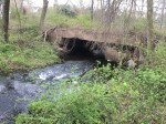
At the end of the road is Old Hebron Ave Bridge where the road once crossed Roaring Brook. Nearby is Shoddy Mill Pond Dam, the remains of an old blacksmith shop.
In the 1960’s, the area was used as a chicken farm and many of the old coops can still be seen.
PHOTOS:

Nearby:
